
Architecture, Engineering, and Construction Industries
Transforming Industries With 3D LiDAR models & Scans and Drone Technology
Achieve Superior Results in Architecture, Engineering, and Construction With Aerial Insights
Elevate your vision and discover new possibilities with our aerial imaging solutions. MorLo Aerial Imaging harnesses the latest drone technology to provide high-quality aerial photos and comprehensive reality capture services, specifically designed for the architecture, engineering, and construction industries.
Based in the beautiful Puget Sound Region, we combine precision and creativity to help you enhance project efficiency and achieve your goals with stunning visual insights. Request a project today!
Deliverables Include:
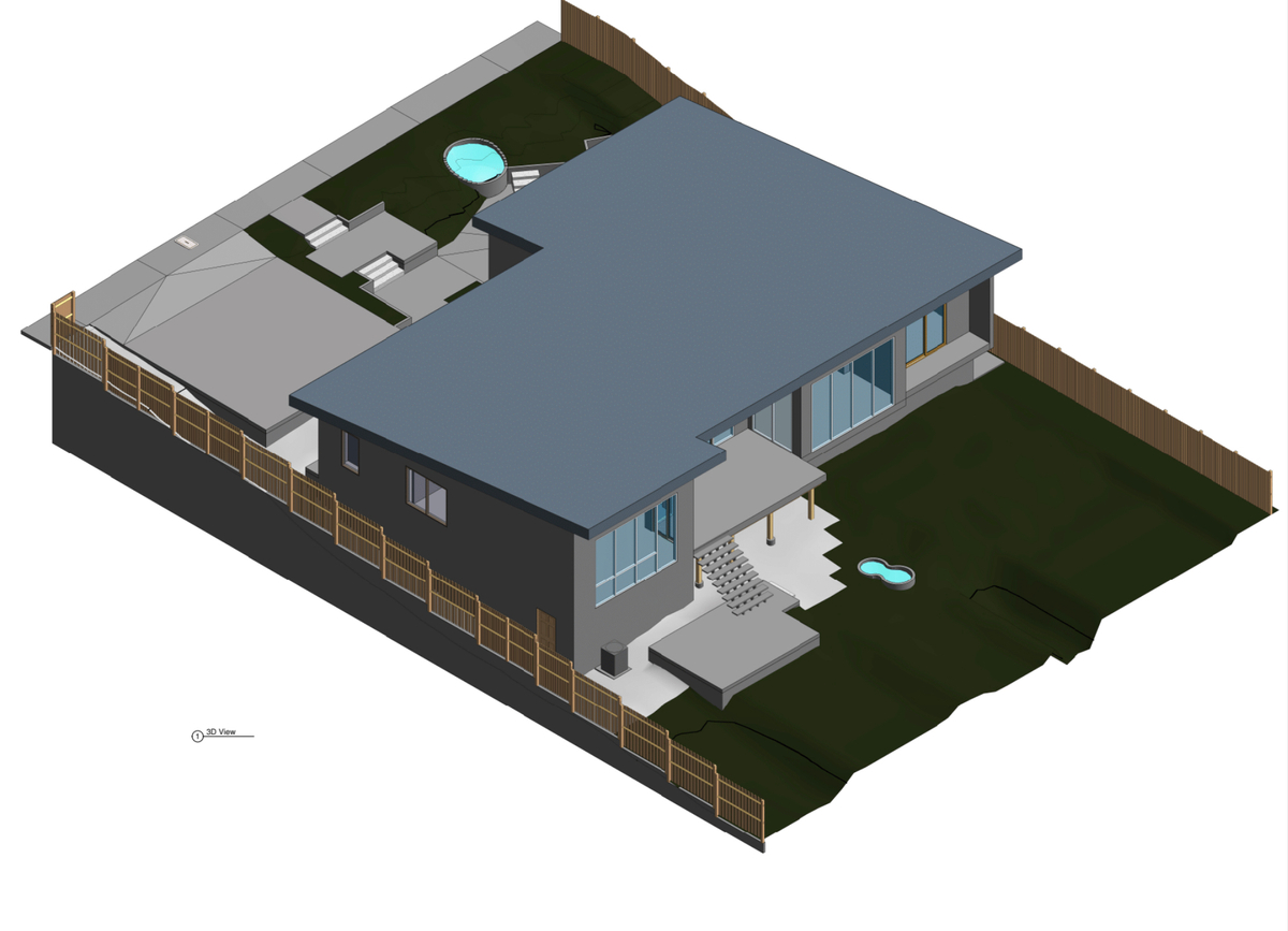
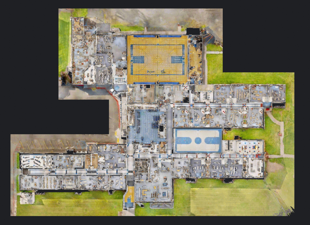
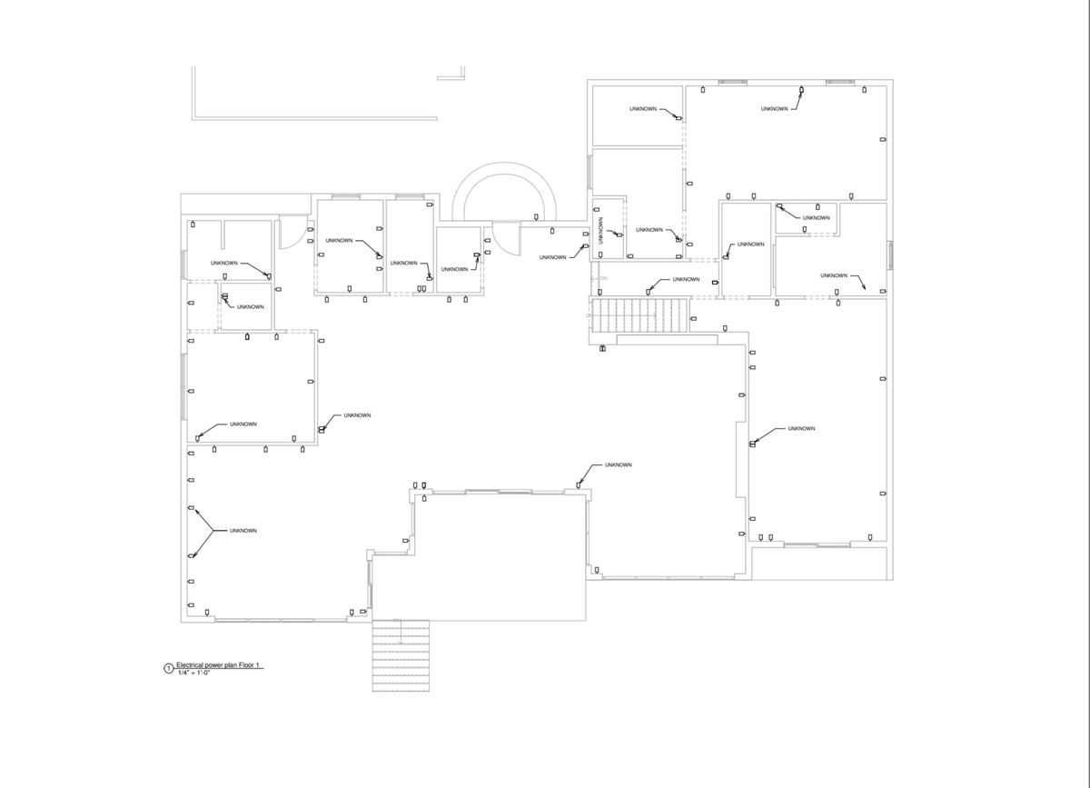
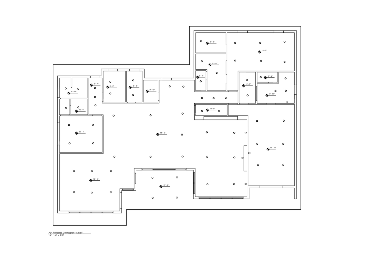
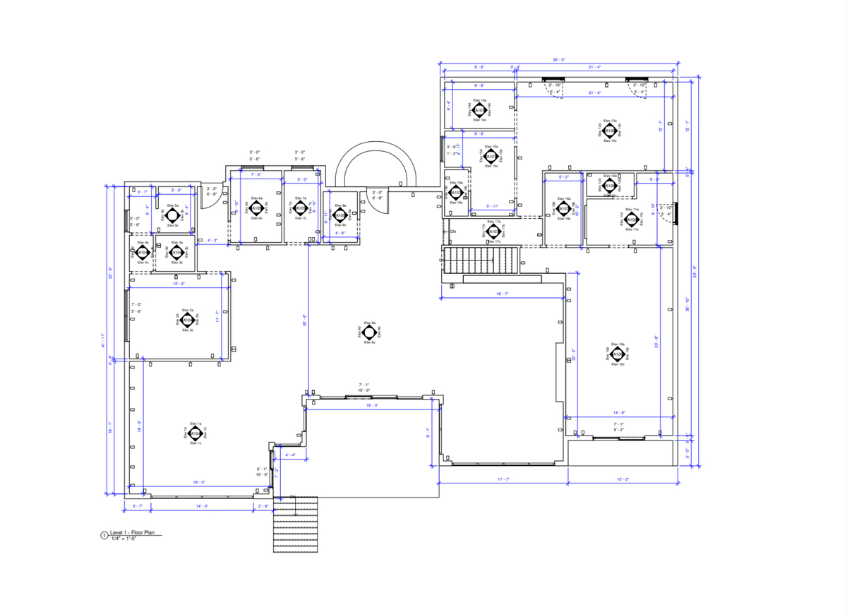
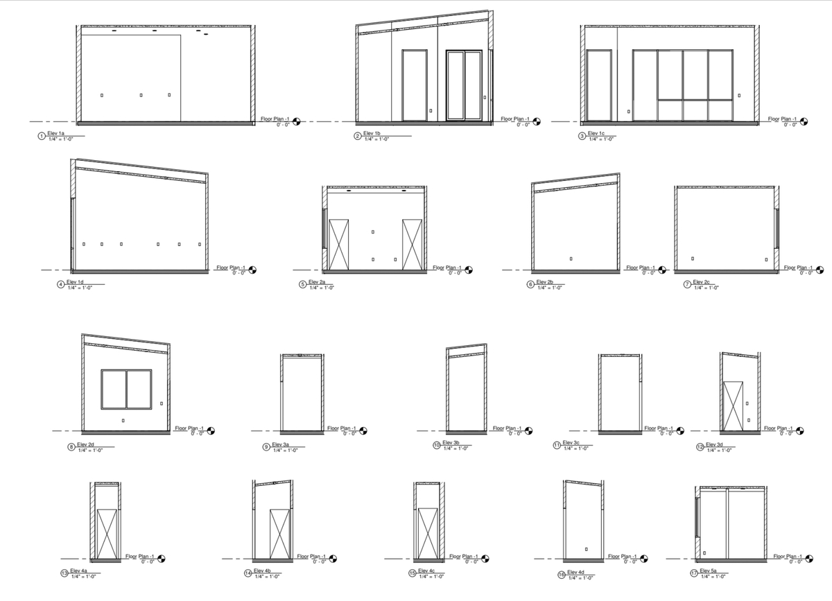
- Ground-based/interior/exterior LiDAR scanning
- Scan to CAD
- Technical Assets (.OBJ, .XYZ, etc.)
- Scan to BIM
- As-Built Documentation
- 3D Digital Twin
- Sync with Procore and Autodesk
- Schematic Floor Plans
- Much more
Aerial/Drone Mapping/Orthomosaics and Inspections:
- Visual Imagery
- Thermal Imagery
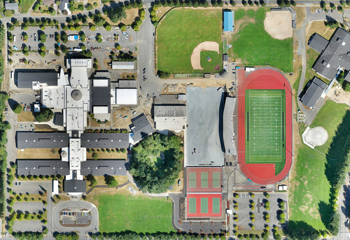
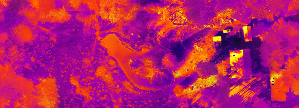
Data Comes In Many Forms

Engineering: Optimize Project Efficiency
Our drone capabilities enable rapid and accurate data collection, allowing engineers to assess sites efficiently and identify potential issues before they arise. Detailed 3D models and aerial photogrammetry mapping provide valuable insights into complex environments, ensuring that you stay on schedule and within budget. By leveraging our services, engineering teams can optimize workflows and enhance project outcomes across all stages of development.
Improve Decision-Making With Accurate Data
We know that having the right information is crucial for successful projects. Our aerial imaging tools are designed to help help you visualize project progress, identify potential issues early, and enhance your workflows, leading to improved project outcomes.

Construction: Inspect with Confidence
Our aerial inspections enhance safety and efficiency by quickly identifying potential issues without disrupting workflow. Capture progress with stunning aerial photographs and videography, offering stakeholders a clear view of the project’s status. Our reality capture services also provide accurate 3D models, making it easier to manage resources and timelines effectively.

Architecture: Design with Precision
Looking to empower your architectural vision with our advanced aerial imaging services? Our high-resolution drone aerial pictures capture every angle and detail, providing essential visual insights for your designs. Utilize our reality capture solutions to create accurate 3D models that facilitate seamless collaboration with clients and stakeholders.
The Future of Project Management Awaits
Embrace the future of architecture, engineering, and construction with MorLo Aerial Imaging. Our commitment to precision, quality, and timely delivery means your projects can achieve innovative outcomes like never before. Partner with us today!