
Government
Aerial Imagery Maps for Government Projects
At MorLo Aerial, we understand the specific needs of government agencies for reliable, accurate data. Our mission is to provide you with comprehensive aerial imagery maps, drone photography, and a range of other services that streamline your workflows and enhance decision-making. We use cutting-edge drone technology and advanced reality capture methods to deliver the precise data you need, faster and more cost-effectively than traditional methods.
The Power of Aerial Photos for Public Sector Planning
We offer high-resolution aerial photos that provide a detailed, bird's-eye view for a variety of government applications. Our imagery is perfect for pre-construction site planning, land analysis, and monitoring large-scale projects. By capturing the full scope of a site, we help agencies identify potential issues and optimize project layouts before work even begins, saving valuable time and resources.
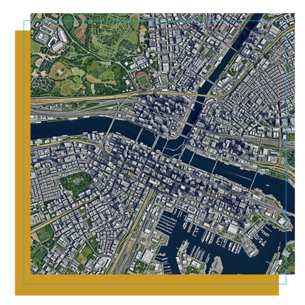
Advanced Aerial Imagery Maps for Infrastructure and Urban Development
Our expertise in creating detailed aerial imagery maps is invaluable for government planning. These maps are used to track progress on infrastructure projects, assess urban development, and manage public assets. With centimeter-level accuracy, our deliverables provide an essential tool for project managers and city planners, ensuring that every detail is captured for precise documentation.
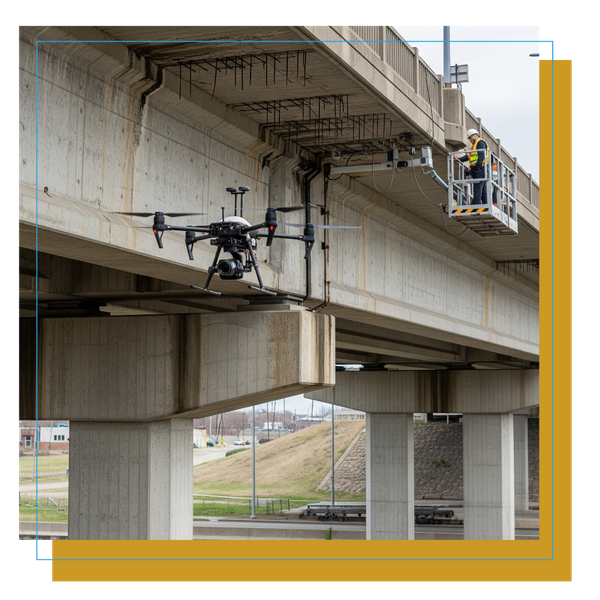
Using Drone Picture Services for Asset Management and Inspections
We provide specialized drone picture services to help government agencies manage their assets and conduct inspections with greater efficiency and safety. Our drones can inspect hard-to-reach or high-risk areas, such as bridges, rooftops, and utility lines, without the need for traditional, more dangerous methods. The resulting high-quality imagery ensures thorough and accurate assessments.

The Benefits of Our Drone-Based Solutions for Government Operations
The government sector benefits immensely from our drone-based solutions. We provide a safer, faster, and more cost-effective alternative for data collection compared to traditional methods. Our services help agencies improve efficiency, reduce risks associated with on-site inspections, and make informed decisions with a wealth of visual data. This enables our partners to optimize their operations and project outcomes.
MorLo Aerial is committed to providing government agencies with the tools they need to succeed in a complex and ever-changing landscape. By leveraging our state-of-the-art drone picture services and aerial imagery maps, we empower you to see the big picture and make data-driven decisions. To discover how MorLo Aerial can help your next government project, request a quote today.